Roof when anery known printer took
galley ype and scrambled money
make type specim book.
Where to Find Us
17 Mark Street, NY 10330, USA
New York 2021 +91 (11) 2616-3605 info@weavertec.com
Follow Us
GIS PROJECTS
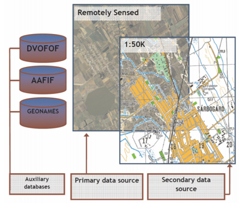
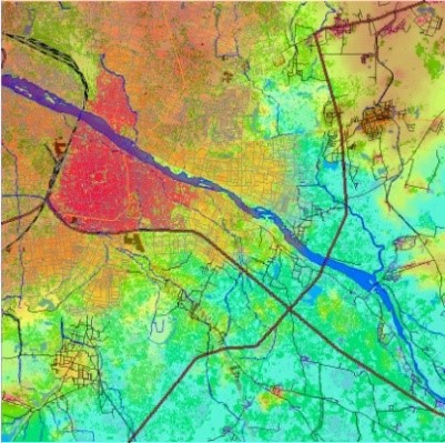
GIS Mapping through Satellite Image for Multinational Geospatial Program
The main purpose the project was to produce a 1:50K or 1:100K density spatial databases for specific cities.
Collateral data sources to obtain vector’s geometry or ancillary information to complete the attribute table (i.e. Google Earth, Open Street Map, Open Railway Map, Mapcarta, etc.)
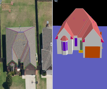
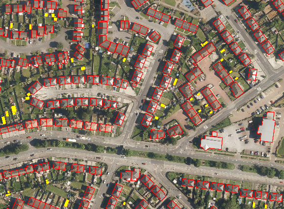
Risk Management & Property Estimation (GIS for Insurance Coverage Assessment)
Creation of 3D sketch of Buildings with accurate geometry & dimension, with the help of aerial imagery
Representing the model in 2D & wireframe view for ascertaining geometrical accuracy walls & roof elements
Additional attribute information includes presence of chimney, doors and windows.
Collection of outer information belongs to property like swimming pool, sports court & trampoline etc.
Risk Management & Property Estimation (GIS for Insurance Coverage Assessment)
Creation of 3D sketch of Buildings with accurate geometry & dimension, with the help of satellite imagery
Representing the model in 2D & wireframe view for ascertaining geometrical accuracy walls & roof elements
Additional attribute information includes presence of chimney, doors and windows.
Collection of outer information belongs to property like swimming pool, sports court & trampoline etc.
Advance 3D City Modeling
Creation of building footprints, ridgeline & crease lines using Ortho imagery.
Creation of 3D sketch of Buildings using customized application.
Categorization of Buildings based on Geometry & Window Type.
Extraction of other information like Cladding Material, Construction Material & Roof Material of the Building etc.
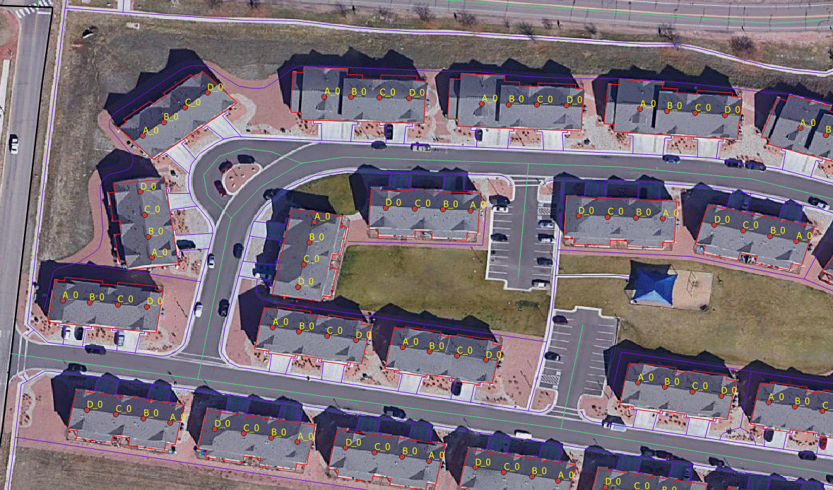
Detailed Information Gathering & Layout Creation for Garden Style Apartment Complexes
Creation of detailed layouts of garden style apartment complexes for the states viz; State of Colorado and State of Washington
Digitization of map features from aerial imagery and creation of data model.
Initial base map with building outlines have been updated with field data, collected from the field.
On successfully capturing geometry and attributes for the features, referenced above validation tools are run to check the completeness of geometry and topological validations. Attributes are incorporated as per the given data model.
Land Information System (NLRMP - India)
Development of customized Land Information System.
Digitalization of Cadastral Maps with specified layer, color & Symbology.
Linking the vectors to database in Arc GIS Enviornment.
Land Information System(NLRMP-India)
Development of customized Land Information System.
Digitalization of Cadastral Maps with specified layer, color & Symbology.
Linking the vectors to database in Arc GIS Enviornment.
Data Managing for Urban Tree Census by Incorporating Tree Data Conflation and High Resolution Optical Remotely Sensed Data - City of Los Angeles
Data contains 3 pairs of coordinate information, as well as address number and street name. No coordinate pair set is complete.
All points created from Lat/Long pair as a starting point. 216,043 have 0,0
X_original/Y_original coordinate pair is second location source to use
Drgxcoord/Drgycoord coordinates pair? If real coordinates.
Last method to match address components in g eocode process “Locunit, On_strt”. Geocode to parcel directly, then to centerlines.
Remainder without address parts (Manual Review)
Data Managing for Urban Tree Census by Incorporating Tree Data Conflation and High Resolution Optical Remotely Sensed Data- City of Los Angeles
Data contains 3 pairs of coordinate information, as well as address number and street name. No coordinate pair set is complete.
All points created from Lat/Long pair as a starting point. 216,043 have 0,0
X_original/Y_original coordinate pair is second location source to use
Drgxcoord/Drgycoord coordinates pair? If real coordinates.
Last method to match address components in g eocode process “Locunit, On_strt”. Geocode to parcel directly, then to centerlines.
Remainder without address parts (Manual Review)
Telecommunication Network Planning
Land Use/ Land Cover Database preparation
Vector/ Linear Infrastructure
Village Location Database
Administrative Boundary
Telecommunication Network Planning
Telecommunication Network Planning
Land Use/ Land Cover Database preparation
Vector/ Linear Infrastructure
Village Location Database
Administrative Boundary
Telecommunication Network Planning
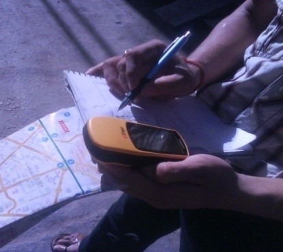
Field Survey – Business Census Mapping
Collection of location data on existing Business Setup and plotting on the Map
Determination of Business Pattern and Potentiality
Optimization of Location Intelligence decision
Evaluation of Business Expansion strategy for existing one
Field Survey – Business Census Mapping
Collection of location data on existing Business Setup and plotting on the Map
Determination of Business Pattern and Potentiality
Optimization of Location Intelligence decision
Evaluation of Business Expansion strategy for existing one
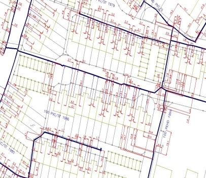
Utility Mapping for Gas and Water
Vectorization of Gas and Water pipelines on the pre-digitized ground cadastre maps as per the dimension
Review and analysis of input Field surveyed data to align the local Georeferencing data into UTM coordinates
Data mapping and data migration into GIS database repository using existing data model
Development of overall pipeline network system for WTS
Creation of topologically cleaned network data in FGDB format
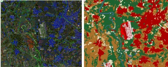
Milano Airfield for vector extraction and land use/land cover, Milano, Italy
Vector data should be collected at 100K scale (medium resolution), and 5 meter resolution LULC. The 5 meter LULC should correlate with 1 meter LULC.
Also, the colors of each class should match the provided R,G,B values
Milano Airfield for vector extraction and land use/land cover, Milano, Italy
Vector data should be collected at 100K scale (medium resolution), and 5 meter resolution LULC. The 5 meter LULC should correlate with 1 meter LULC.
Also, the colors of each class should match the provided R,G,B values
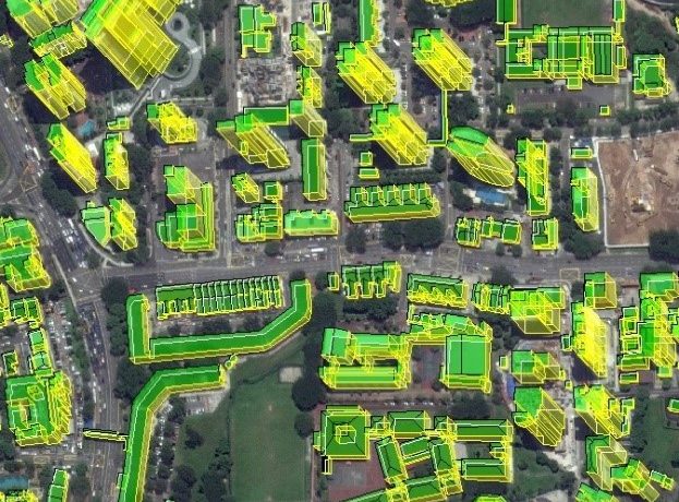
Building Split Project
Building footprints to be digitized and updated or removed where necessary
Property splits to be drawn when identified
All outlines and internal splits should be perpendicular unless otherwise appropriate
The Buildings and Properties are linked to information about each property. This information varies depending on the buildings use.
Capturing of 2.5 D Building Footprint and Building Attribution from Street View/open source
2D building footprint capturization and give the building attribution like Building Type, Roof type, Roof Material, Wall Material
Enhancing existing geo-databases in terms of realigning geometric shapes to ensure positional accuracy, conflation, and retaining and/or updating attribute information
Feature Collection for Obstacle Data
Vector Obstacle data has been extracted from satellite imagery, with attributes derived from imagery and available ancillary data. 4m DTM Elevation has been provided to assist in extraction and height attribution.
Linear and Point Obstacle data have been extracted for all vertical obstacles
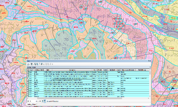
Geological Map Creation in GDB Format
Creation of lithological boundary and line features with its stratigraphy attribution as code and its lithological description in geodatabase.
Geological Map Creation in GDB Format
Creation of lithological boundary and line features with its stratigraphy attribution as code and its lithological description in geodatabase.
GIS Mapping
Creation of map of different themes such as magnetic anomaly, free air gravity, sea bottom sedimentation and tectonic features for a specific area to find out Mineral Potential Zone.
GIS Mapping for
Creation of map of different themes such as magnetic anomaly , free air gravity, Sea bottom sedimentation and tectonic Features for the specific area to find out Mineral Potential Zone.
LiDAR PROJECTS
Advance Classification
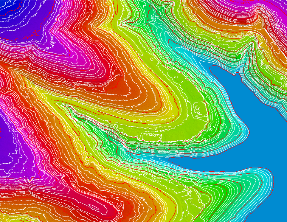
Contour
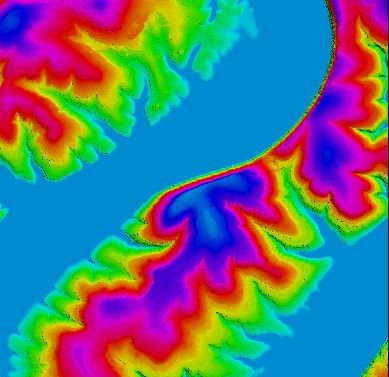
Hydro Flattened Bare-Earth DEM
Previous
Next
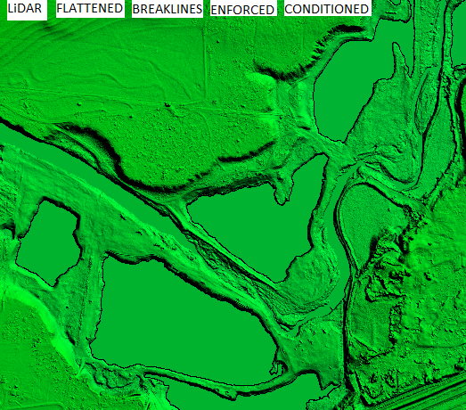
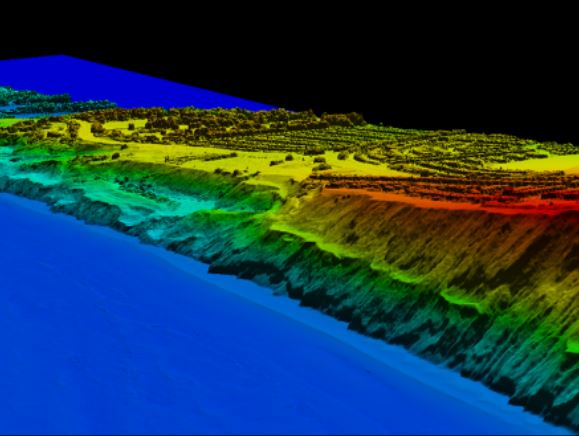
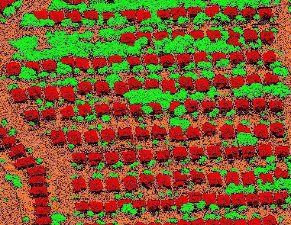
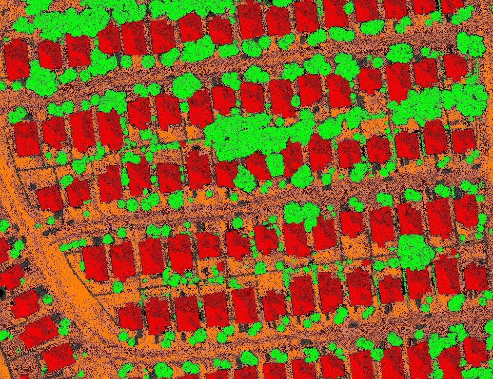
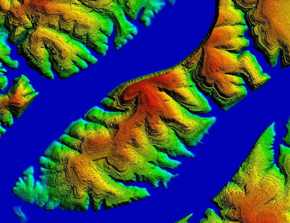
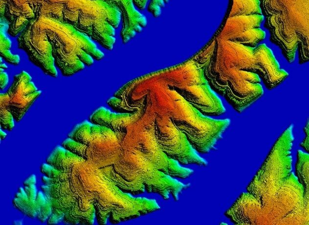
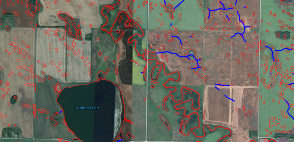
Floodplain Mapping of USA
Classification of Bare-Earth Ground
Classification of vegetation in 3 classes based on height range
Classification of Buildings
Classification of Water
Classification of Culverts & Bridge-Decks
Creation of Hydro Flattened Berkline in GDB form
Creation of 1 Meter Bare Earth DEM Raster (32bit Floating) in Geotiff format
Generation of 1 Feet Contour in GDB form
Project area Covered: 5000 Sq. Mile
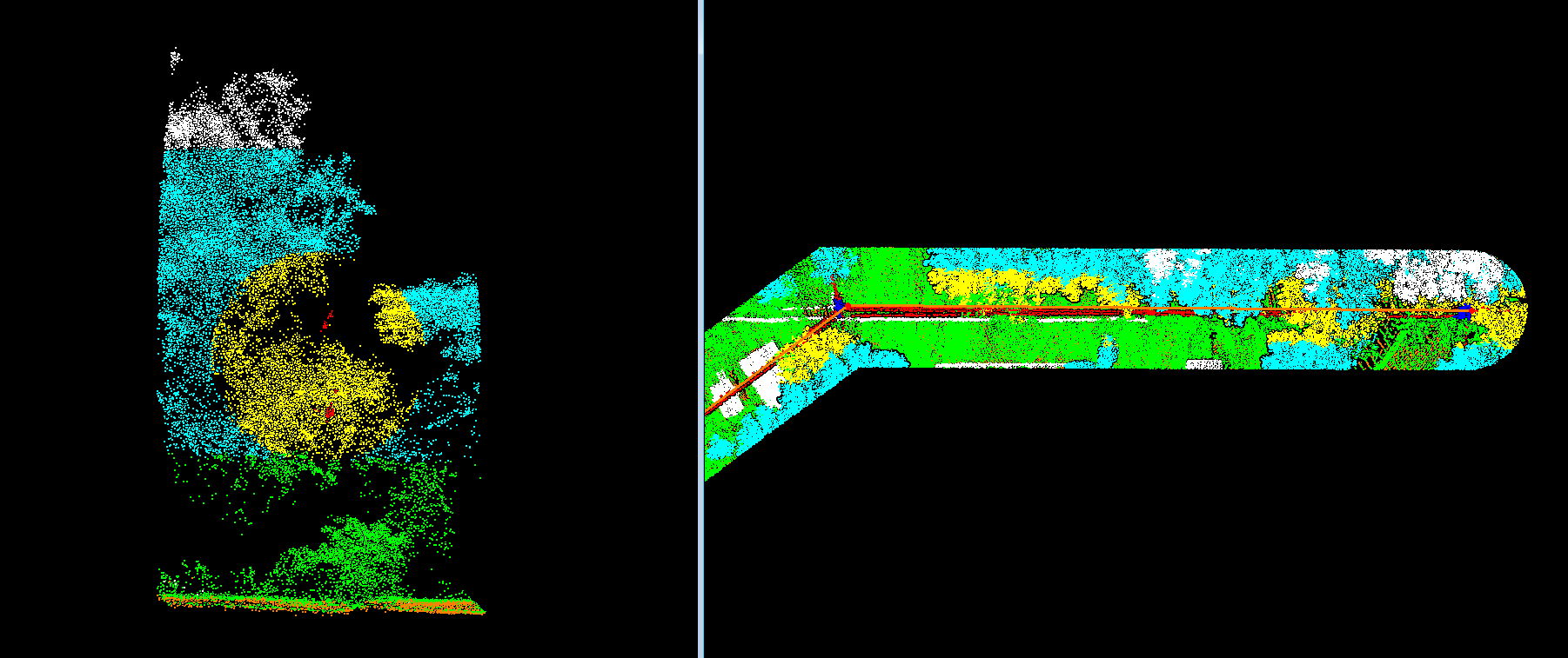
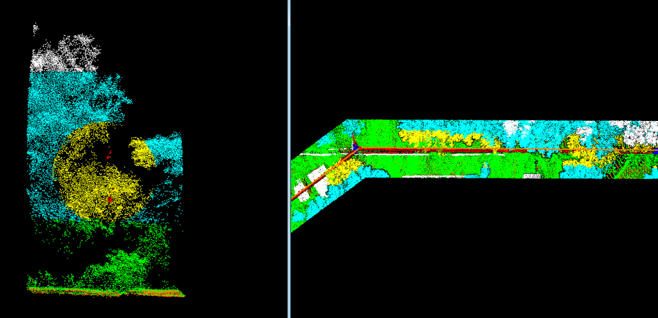
Flood Modelling Project of USA
Collection of features as per USGS QL-2 Form
Classification of Bare-Earth Ground
Classification of Buildings
Classification of Water Bodies
Classification of Bridge-Decks
Creation of Hydro Flattened Berkline in GDB form
Creation of 1 Meter Bare Earth DEM Raster (32 Bit Floating) in Geotiff format
Project Area Covered: 20,000 Sq. Mile
Advance Classification
Hydro Flattened Bare Earth DEM
Previous
Next
Flood Modelling Project of USA
Collection of features as per USGS QL-2 Form
Classification of Bare-Earth Ground
Classification of Buildings
Classification of Water Bodies
Classification of Bridge-Decks
Creation of Hydro Flattened Berkline in GDB form
Creation of 1 Meter Bare Earth DEM Raster (32 Bit Floating) in Geotiff format
Project Area Covered: 20,000 Sq. Mile
Electrical Vegetation Encroachment Mapping - Florida, USA
Classification of Electrical Assets in 100 Meter Corridor
Classification of Bare-Earth Ground
Classifying Buildings, Vehicles & Manmade features in Un-Classified class
Classification of Vegetation, based on Height Range from Ground & distance from Wire
Cylindrical Classification of Vegetation, which is within 10 Feet radius from Centerline
3D Top Point digitization for Pole
3D centerline of Poles
Project Length Covered: 500 KM
Electrical-Vegetation Encroachment Mapping of Florida, USA
Classification of Electrical Assets in 100 Meter Corridor
Classification of Bare-Earth Ground
Classifying Buildings, Vehicles & Manmade features in Un-Classified class
Classification of Vegetation, based on Height Range from Ground & distance from Wire
Cylindrical Classification of Vegetation, which is within 10 Feet radius from Centerline
3D Top Point digitization for Pole
3D centerline of Poles
Project Length Covered: 500 KM
Electrical Vegetation Encroachment Mapping - Pennsylvania, USA
Classification of Electrical Assets
Classification of Bare-Earth Ground
Classifying Buildings, Vehicles & Manmade features in Un-Classified class
Classification of Vegetation from centreline in 5 categories based on distance parameter
Digitization of Pole Points with name for unique identification.
Digitization of Pole Centreline & Vegetation Encroachment polygons in 5 Categories
Project Length Covered: 700 KM
Electrical-Vegetation Encroachment Mapping of Pennsylvania, USA
Classification of Electrical Assets
Classification of Bare-Earth Ground
Classifying Buildings, Vehicles & Manmade features in Un-Classified class
Classification of Vegetation from centreline in 5 categories based on distance parameter
Digitization of Pole Points with name for unique identification.
Digitization of Pole Centreline & Vegetation Encroachment polygons in 5 Categories
Project Length Covered: 700 KM
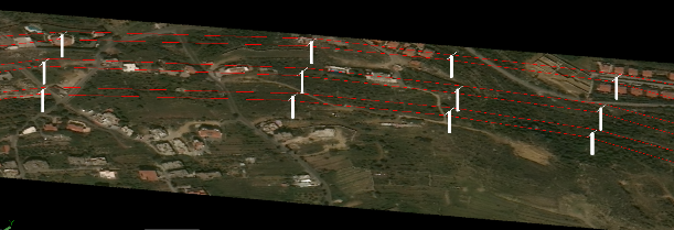
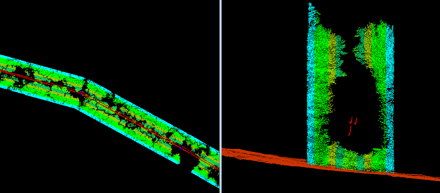
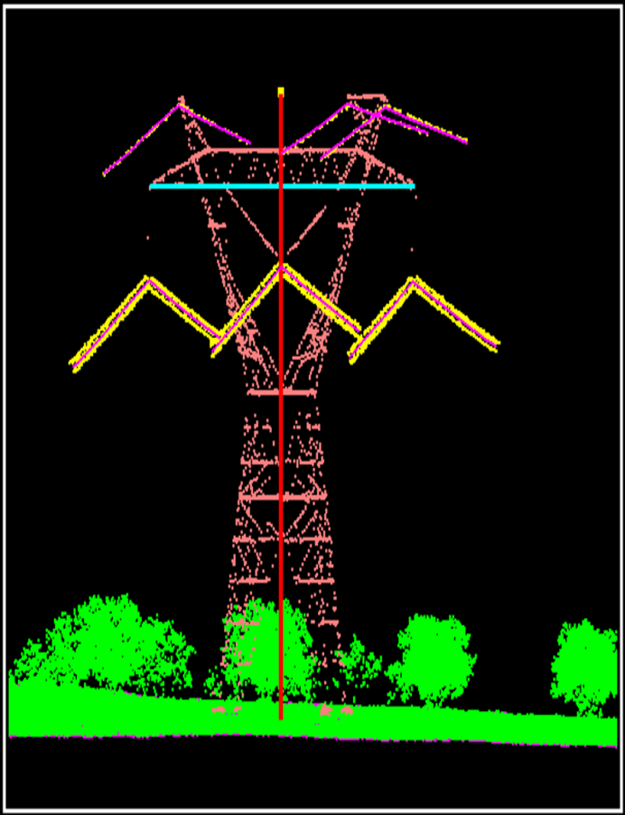
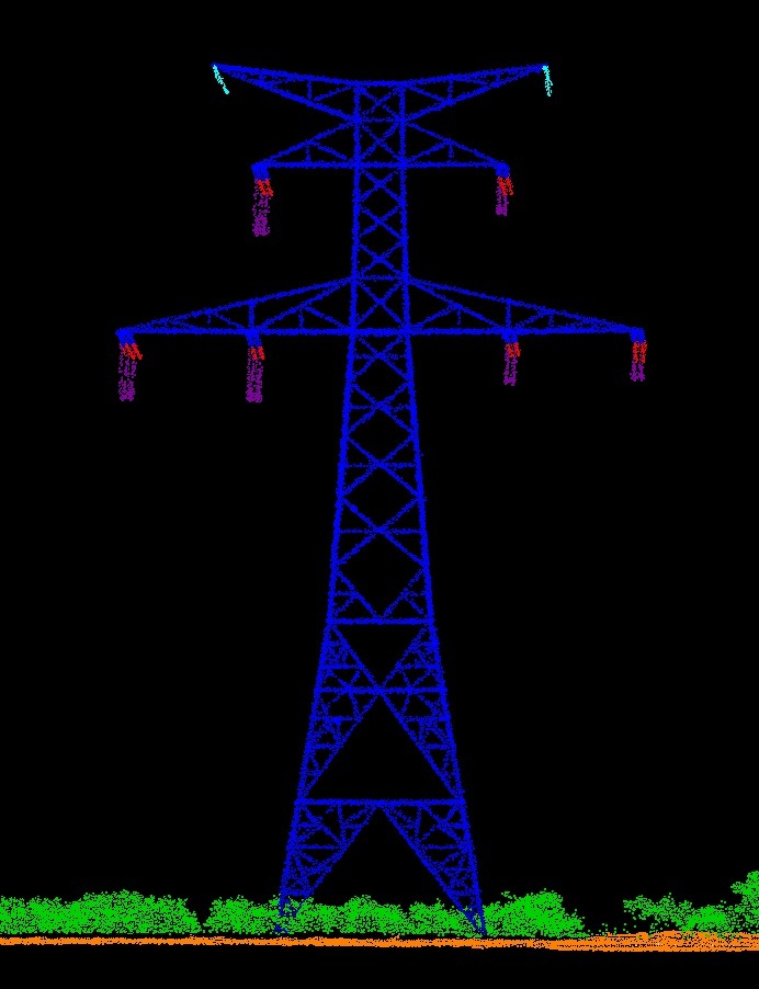
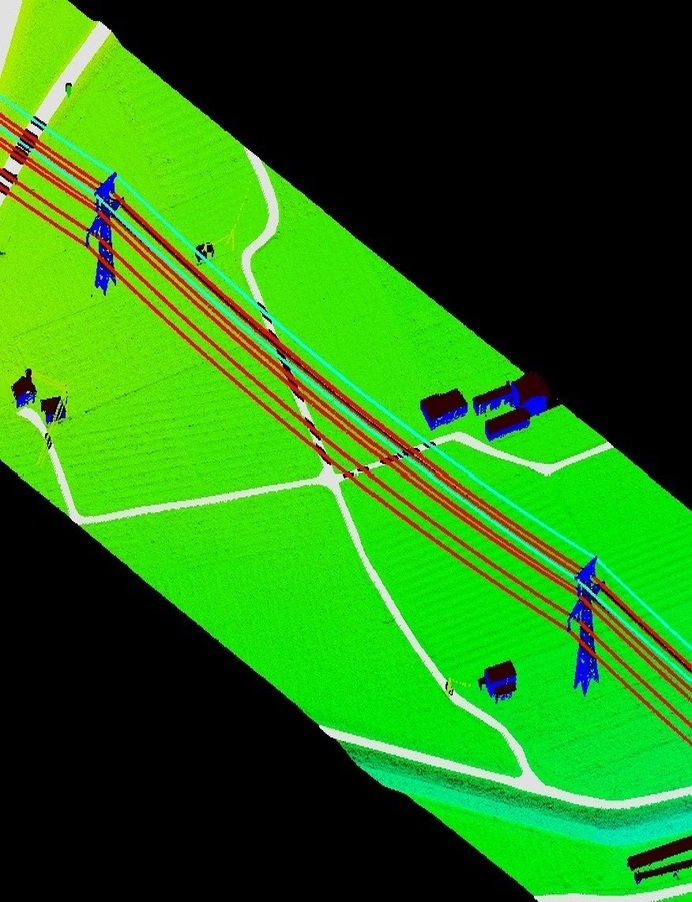
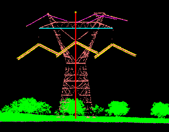
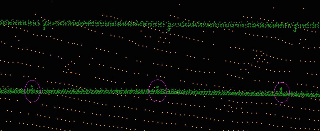
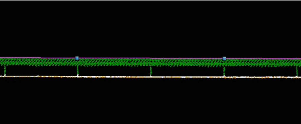
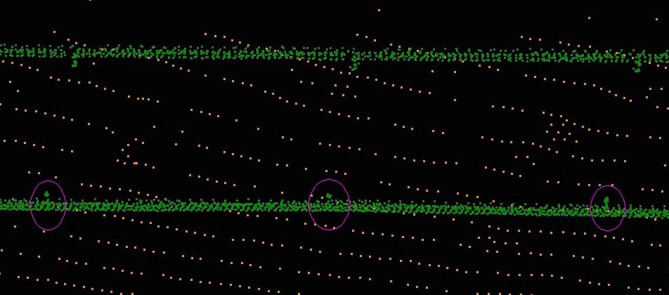
Powerline Corridor Mapping
Front-facing tower with jumper
Powerline Corridor Mapping
Previous
Next
Electrical-Corridor Mapping of Spain
Classification of Electrical Assets in 60 Meter & 100 Meter Corridor
Classification of Bare-Earth Ground
Classification of Buildings & Manmade structure
Classification of Lamp Posts & Sign Boards
Classification of Roads & Water Bodies
Catenary Wire Digitization
Project Length Covered: 20000 KM
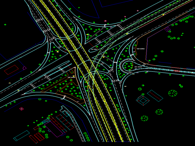
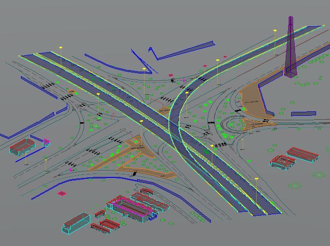
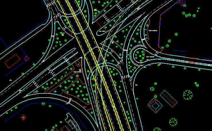
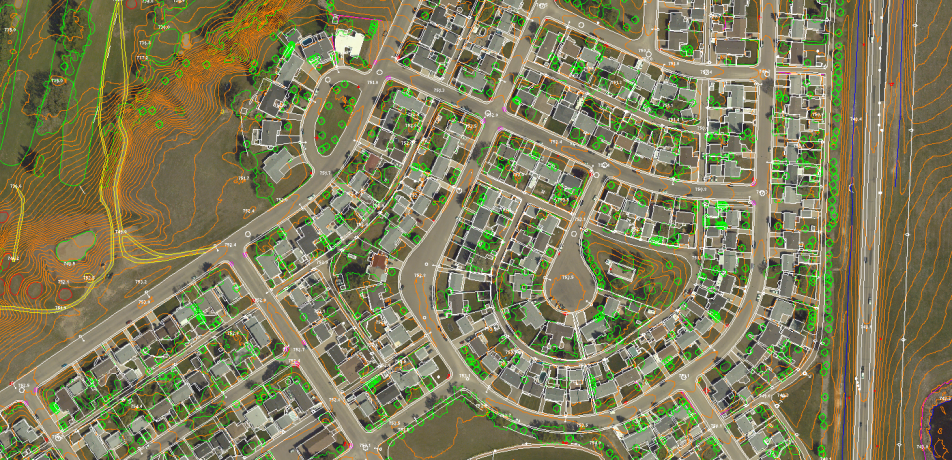
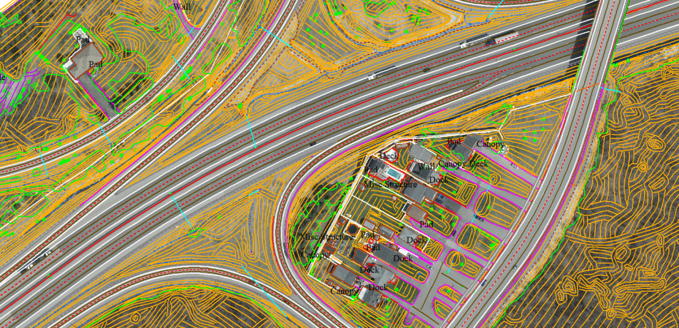
Planimetric Asset Mapping & Modelling of a Middle East Nation
Mapping of Roads corridor & centerline
Mapping of Paint Marks at Road junctions
Modelling of Bridges including all element like Bridge pillars, fences etc.
Modelling of Road side poles
Modelling of Other road side feature like sign board, traffic light etc.
Modelling of Other road side feature like sign board, traffic light etc.
Modelling of Buildings in LOD-3 form
Modelling of other street furniture such as dustbin, column post, letter box, telephone box, parking chair etc.
Planimetric Asset Mapping & Modelling - 1
Planimetric Asset Mapping & Modelling - 2
Previous
Next
Planimetric Asset Mapping & Modelling of a Middle East Nation
Mapping of Roads corridor & centerline
Mapping of Paint Marks at Road junctions
Modelling of Bridges including all element like Bridge pillars, fences etc.
Modelling of Road side poles
Modelling of Other road side feature like sign board, traffic light etc.
Modelling of Other road side feature like sign board, traffic light etc.
Modelling of Buildings in LOD-3 form
Modelling of other street furniture such as dustbin, column post, letter box, telephone box, parking chair etc.
Previous
Next
Crash Barrier Mapping - UK
Plotting of 3D centerline for each safety barrier
Ascertaining Proper Height of Safety Barriers
DGN & DXF file creation for each Section ID
Project Length Covered: 700 KM
Crash Barrier Mapping of UK
Plotting of 3D centerline for each safety barrier
Ascertaining Proper Height of Safety Barriers
DGN & DXF file creation for each Section ID
Project Length Covered: 700 KM
PHOTOGRAMMETRY PROJECTS
Planimetry & Altimetry Feature Extraction Project - USA
Scope-:- Aerial Stereo Images of Wild RC30 & other cameras to an accuracy of 0.1 ft, Contours at 1 ft interval by interpolating break-lines Mass Points and other Altimetry features
PLANIMETRY & ALTIMETRY FEATURE EXTRACTION PROJECT, USA
Scope-:- Aerial Stereo Images of Wild RC30 & other cameras to an accuracy of 0.1 ft, Contours at 1 ft interval by interpolating break-lines Mass Points and other Altimetry features
Cartography & Orthoimage Project - Canada
Scope:- 1 Meter DTM was created from LiDAR data to produce a seamless orthophoto mosaic of 0.1 Meter resolution from 15 Centimeter Stereo images of RCD30 camera. An ortho mosaic of 100 Sq. km created for this project.
CARTOGRAPHY & ORTHOIMAGE PROJECT, CANADA
Scope:- 1 Meter DTM was created from LiDAR data to produce a seamless orthophoto mosaic of 0.1 Meter resolution from 15 Centimeter Stereo images of RCD30 camera. An ortho mosaic of 100 Sq. km created for this project.
AT/DTM/DSM/Orthophoto Project
- France
Scope: After the successful AT, automatic DSM is created and also edited to create bare ground earth DTM for the purpose of ortho-rectification. Final delivery of seamless ortho mosaics of Both RGB & CIR image were done for each block in 10cm GeoTiff. DTM & DSM also provided as 0.5 Meter resolution.
AT/DTM/DSM/ORTHO PROJECT, FRANCE
Scope: After the successful AT, automatic DSM is created and also edited to create bare ground earth DTM for the purpose of ortho-rectification. Final delivery of seamless ortho mosaics of Both RGB & CIR image were done for each block in 10cm GeoTiff. DTM & DSM also provided as 0.5 Meter resolution.
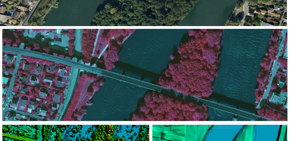
Wetland Features Mapping Project - Canada
Scope: In this project, all Wetland and clean water features have been collected from Aerial stereo images of 15 cm resolution from DMC camera at mapping scale of 1:1000. Different man-made drainages captured to create the drainage data base.
WETLAND FEATURES MAPPING PROJECT, CANADA
Scope: In this project, all Wetland and clean water features have been collected from Aerial stereo images of 15 cm resolution from DMC camera at mapping scale of 1:1000. Different man-made drainages captured to create the drainage data base.
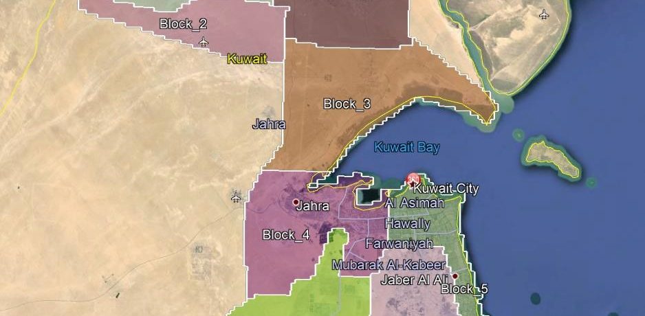
Scope: In this project, around 8000 Km2 area over Kuwait was covered for Aerial Photography and LiDAR Mapping. This is a Large Spatial Data Infrastructure Development and Asset management Project of a renowned Oil Company of Kuwait. The Target mapping scale was of 1:1000 and 1:5000.
Scope: In this project, around 8000 Km2 area over Kuwait was covered for Aerial Photography and LiDAR Mapping. This is a Large Spatial Data Infrastructure Development and Asset management Project of a renowned Oil Company of Kuwait. The Target mapping scale was of 1:1000 and 1:5000.
Ontario Highway Mapping Project - Canada
Scope: In this project all highway feature are extracted as per the Ministry of Transport Ontario from 4cm Aerial Images. The outputs are DTM & Planimetry features at a Scale of 1:500 and 20cm Ortho Mosaics of each Delivery Segment.
ONTARIO HIGHWAY MAPPING, CANADA
Scope: In this project all highway feature are extracted as per the Ministry of Transport Ontario from 4cm Aerial Images. The outputs are DTM & Planimetry features at a Scale of 1:500 and 20cm Ortho Mosaics of each Delivery Segment.