OUR BUSINESS

Geospatial Services

WET has a powerful team of experienced Geospatial Specialists to ensure accurate and fast processing of your GIS Projects. The team is well conversant with the GIS activities such as resource mapping, data conversion, remote sensing, utility mapping, photogrammetry and LIDAR data processing.

We are able to gather and understand the requirements and processes for new projects promptly, ensuring faster starts to projects. These factors combined with our meticulous quality checking process and the cost efficiency of outsourcing to India, give our clients one of the best level of geographical and GIS related services in the industry.

Remote Sensing

  • Agricultural mapping
  • Crop Monitoring & Assessment/Damage Assessment
  • Creation of Topographic Databases
  • Land Use and Land Cover Classification
  • Forest Mapping: Canopy Cover Analysis in Forest Area and Vegetation Index (VI)
  • Water Resource Management/Watershed Management
  • Coastal Ecosystem Monitoring
  • Agricultural mapping
  • Crop Monitoring & Assessment/Damage Assessment
  • Creation of Topographic Data bases
  • Land Use and Land Cover Classification
  • Forest Mapping: Canopy Cover Analysis in Forest Area and Vegetation Index (VI)
  • Water Resource Management/Watershed Management
  • Coastal Ecosystem Monitoring

Remote Sensing

The modern creative communication and internet network connect i

Photogrammetry

  • Aero-Triangulation
  • DTM / DEM / Digital Surface Model
  • Orthophoto Generation
  • 3D Vector Mapping and Planimetric Mapping
  • 2D Vector Mapping from Orthophotos

(Applicable for Aerial Stereo Photos, Satellite Stereo Images and UAV/Drone Stereo Photography)

Aero-Triangulation

Aerial triangulation techniques are used to improve the accuracy of the INS/GNSS/IMU data of aerial images and positional sensor/orbital data of satellite images with the help of accurate ground control points collected by various survey methods. In combination with a minimum number of ground control points and adjoining matching image Tie Points, aerial triangulation delivers best fitting results on the ground for entire block of images. As shown in the image, the entire area’s Aerial images are geo referenced with respect to some known Ground Control Points (GCPs). Only after this process the 3D measurement of the feature and terrain can be performed

Orthophoto Generation

WET specializes in high-resolution orthophoto imagery production. An orthophoto is an aerial photograph/satellite imagery that has been geometrically corrected or ‘ortho-rectified’ such that the scale of the photograph is uniform. An aerial or satellite image is rectified with the terrain data to correct the lean and distortion due to terrain relief, and camera tilt and orientation. This process makes scale of the image uniform. All such adjoining images then mosaicked through the overlap area with the help of seam lines to make it seamless and color balanced both in terms of geometry and radiometry features. An orthophoto is utilised in the same manner as a map of a particular scale.

WET specializes in high-resolution orthophoto imagery production. An orthophoto is an aerial photograph/satellite imagery that has been geometrically corrected or ‘ortho-rectified’ such that the scale of the photograph is uniform. An aerial or satellite image is rectified with the terrain data to correct the lean and distortion due to terrain relief, and camera tilt and orientation. This process makes scale of the image uniform. All such adjoining images then mosaicked through the overlap area with the help of seam lines to make it seamless and color balanced both in terms of geometry and radiometry features. An orthophoto is utilised in the same manner as a map of a particular scale.

3D Vector Mapping / Planimetric mapping

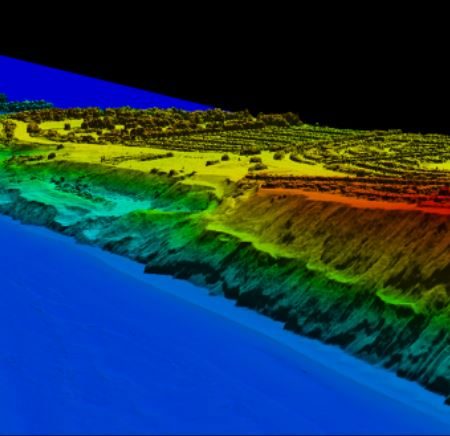
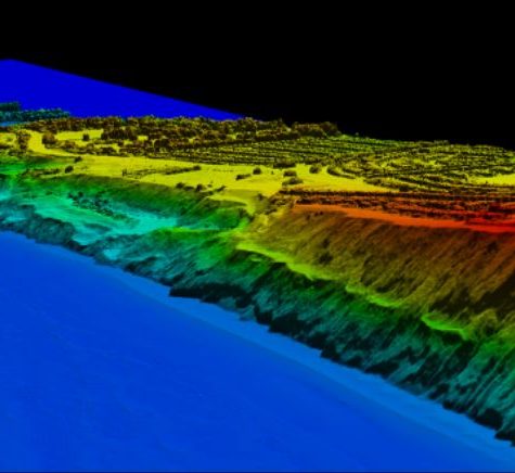
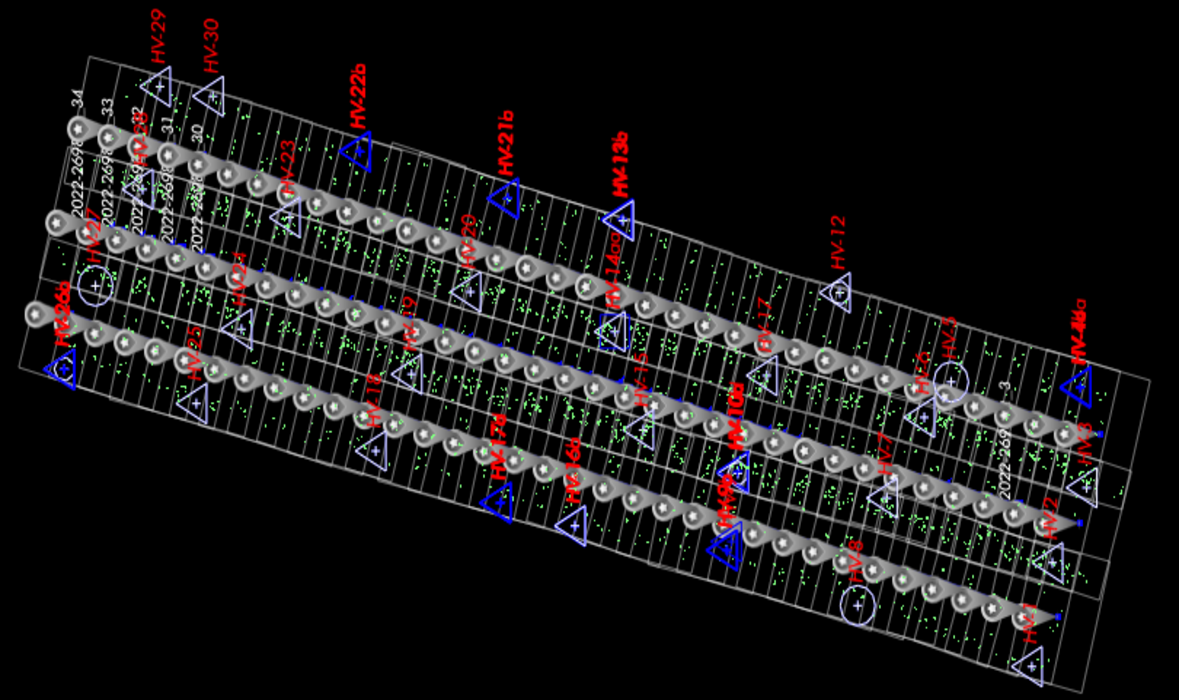
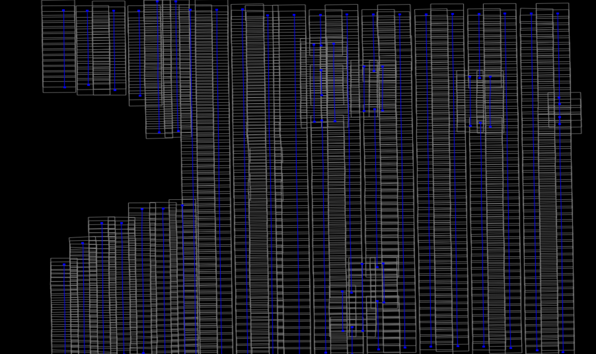
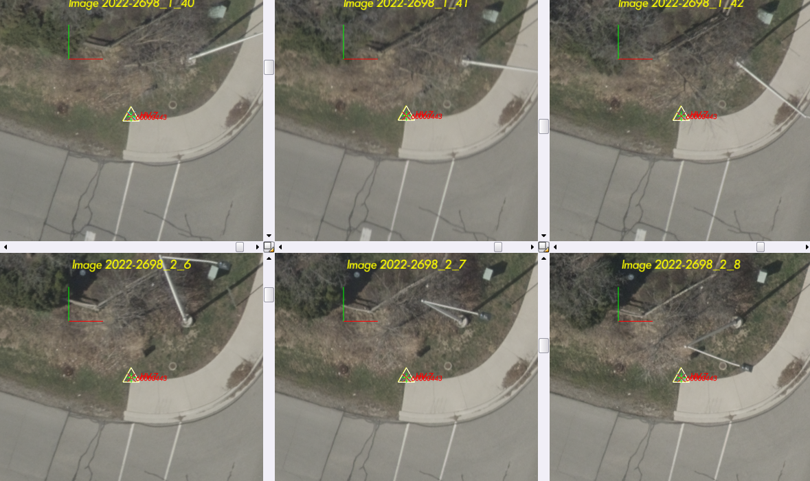
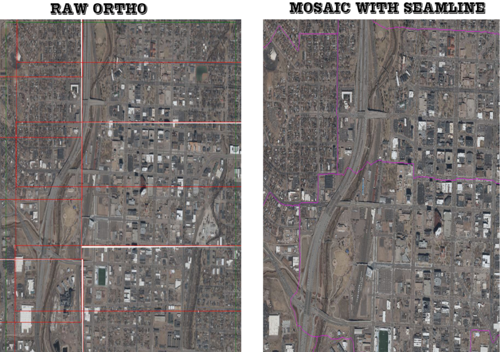
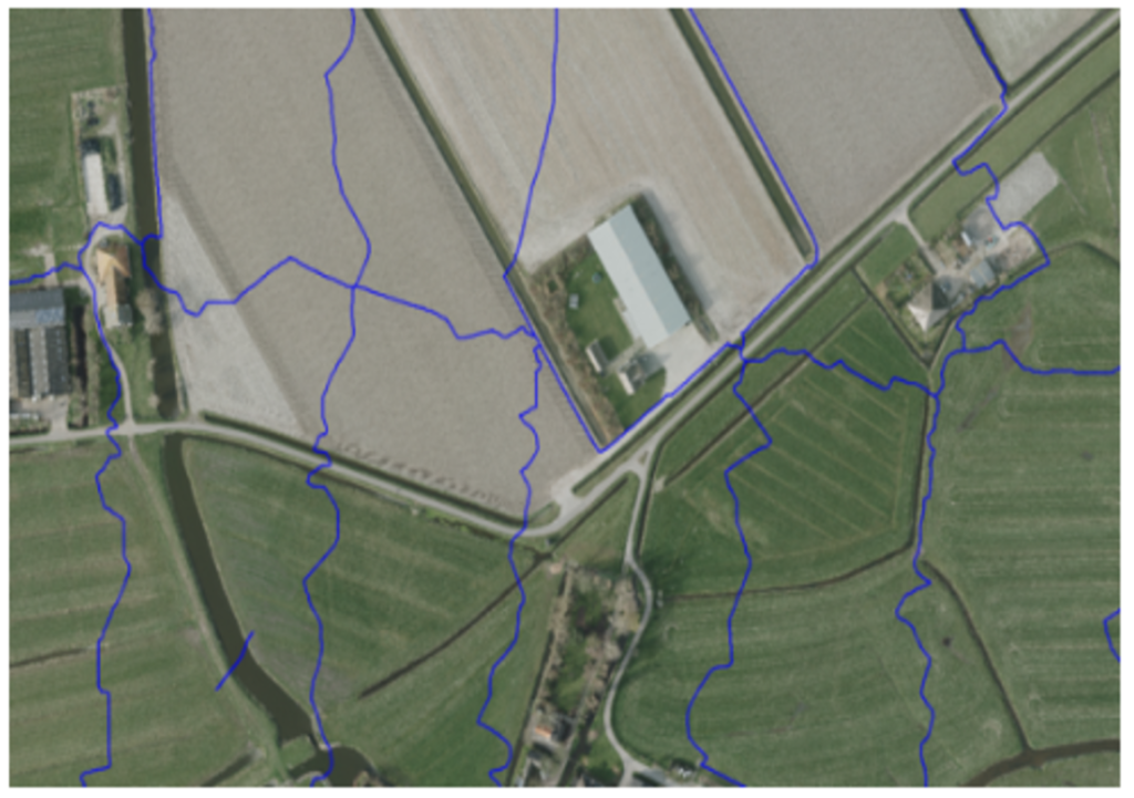
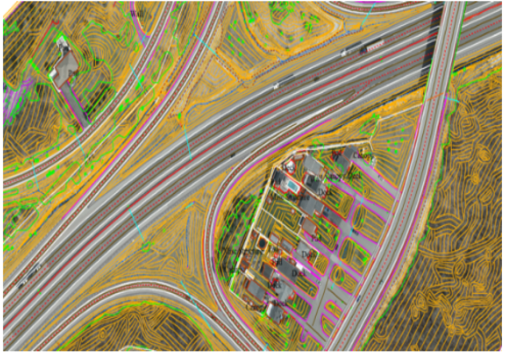
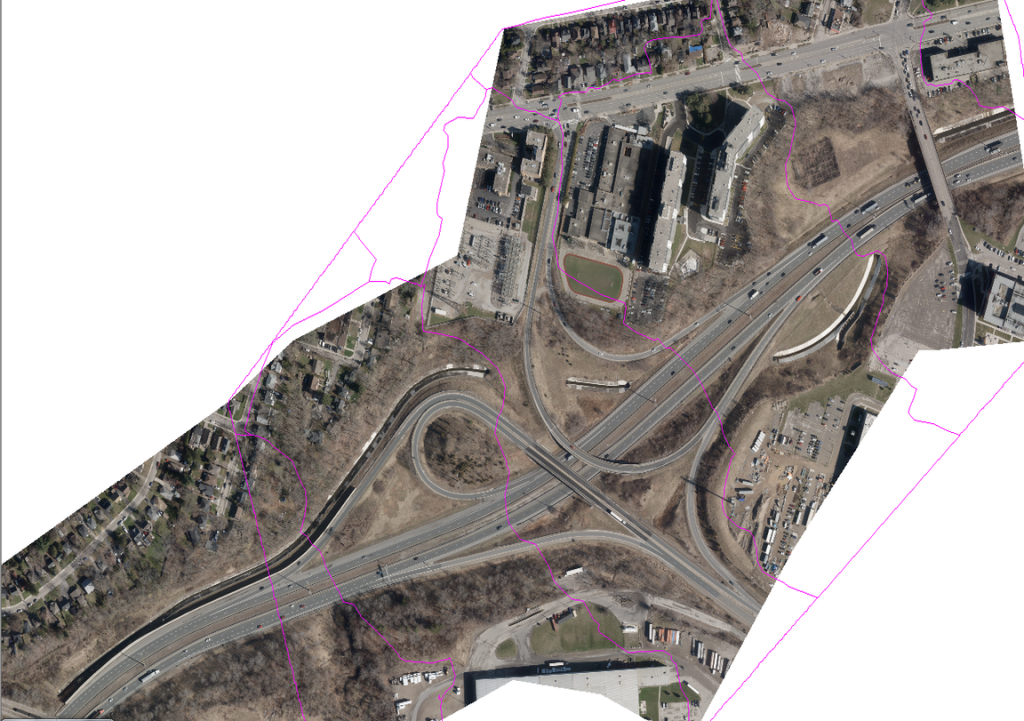
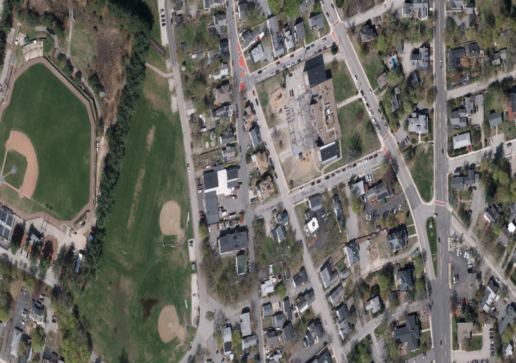
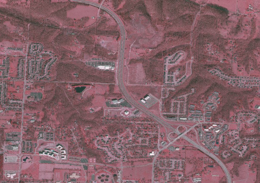
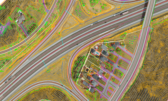
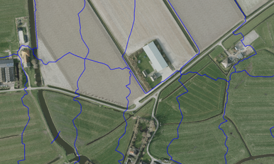
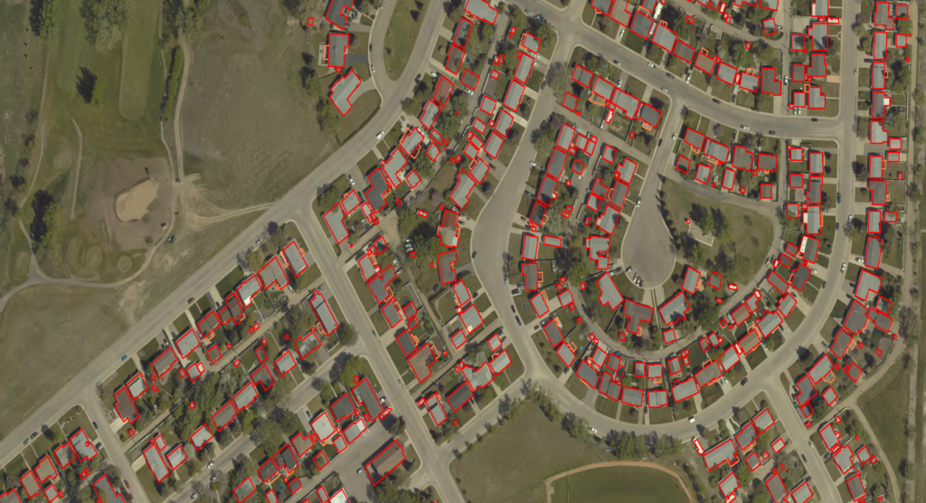
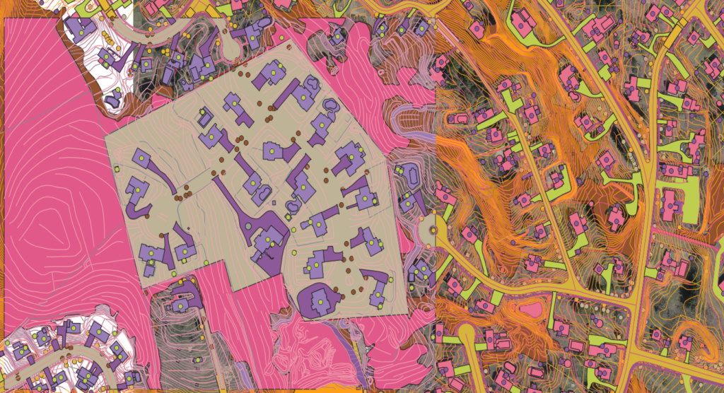
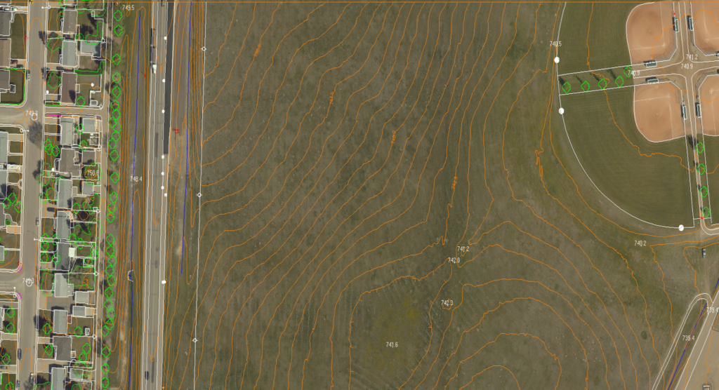
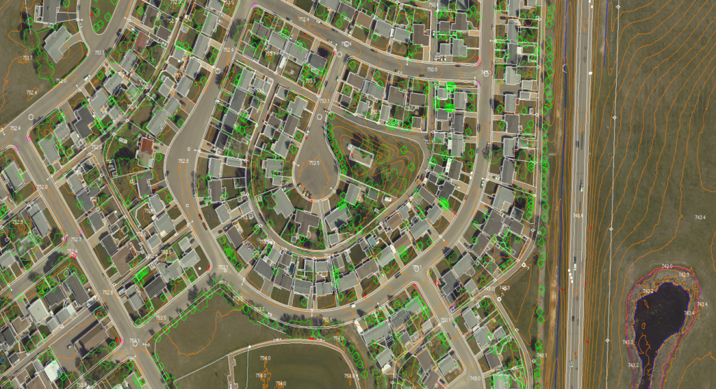
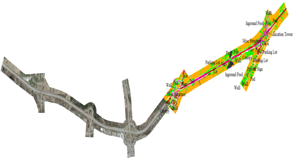
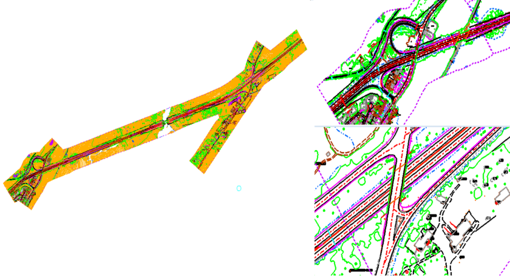
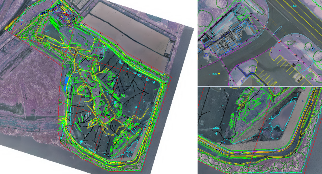
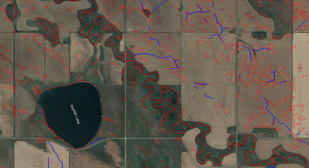
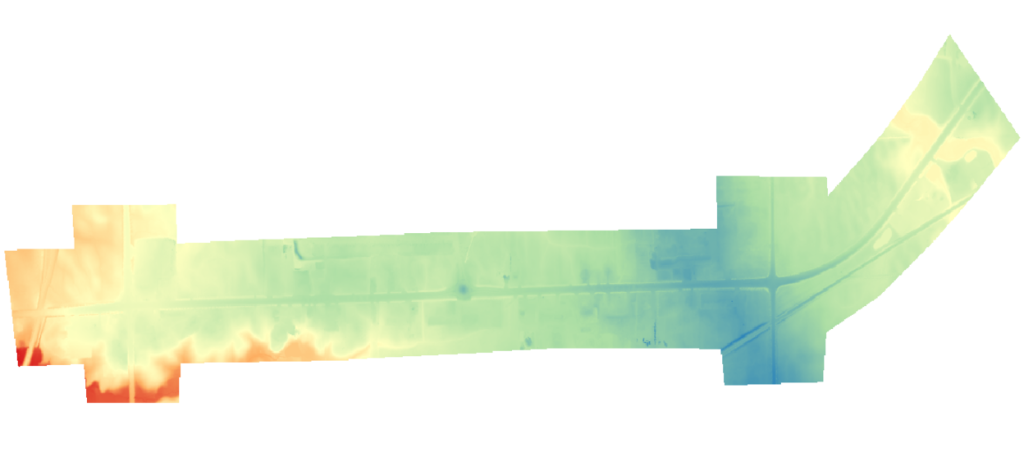
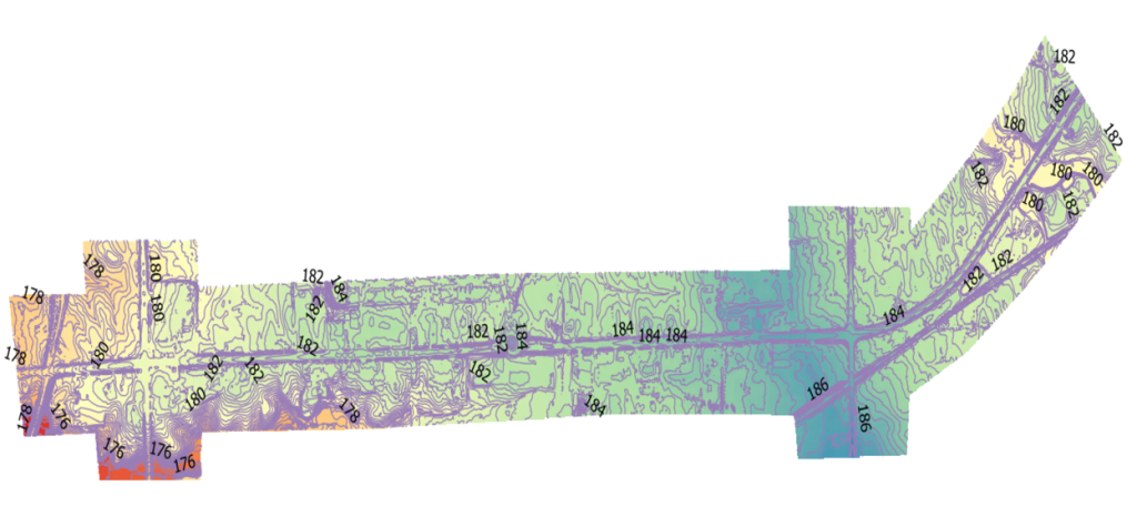
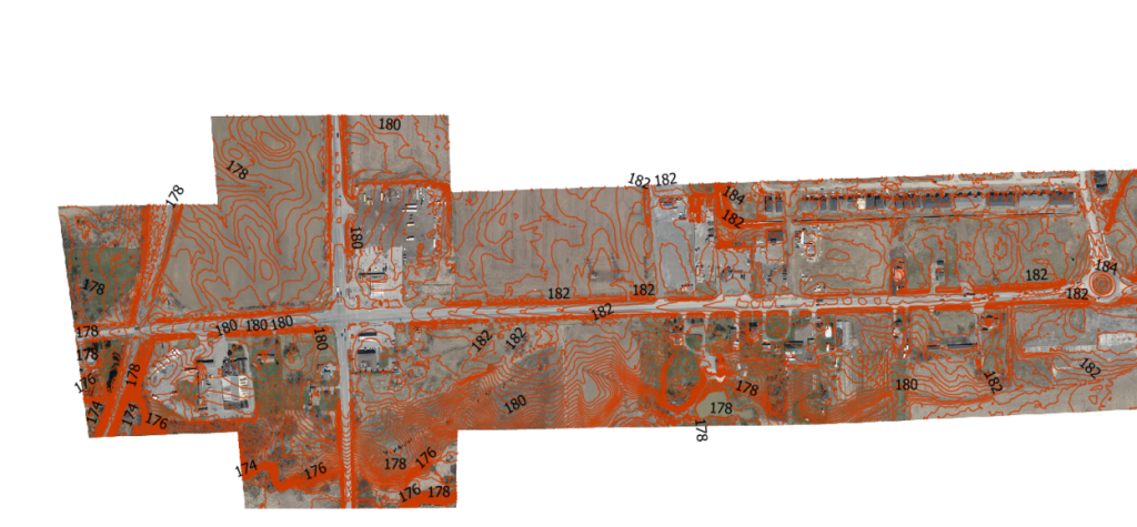
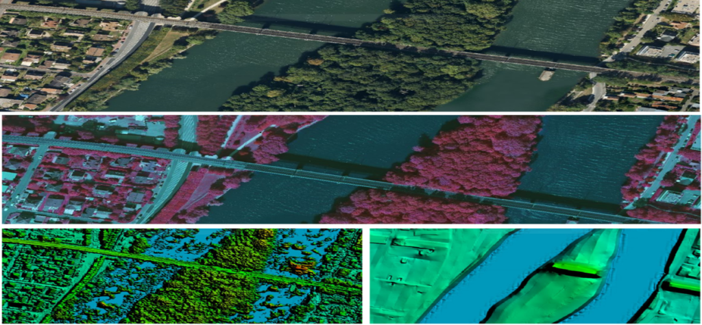
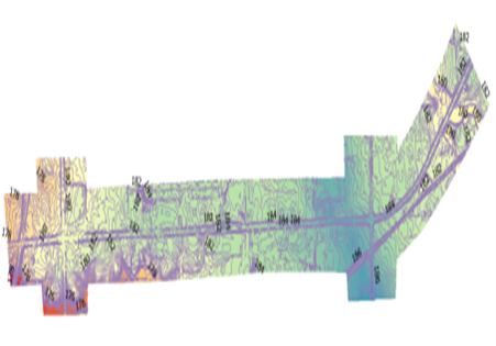
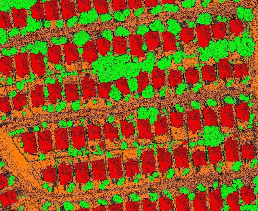
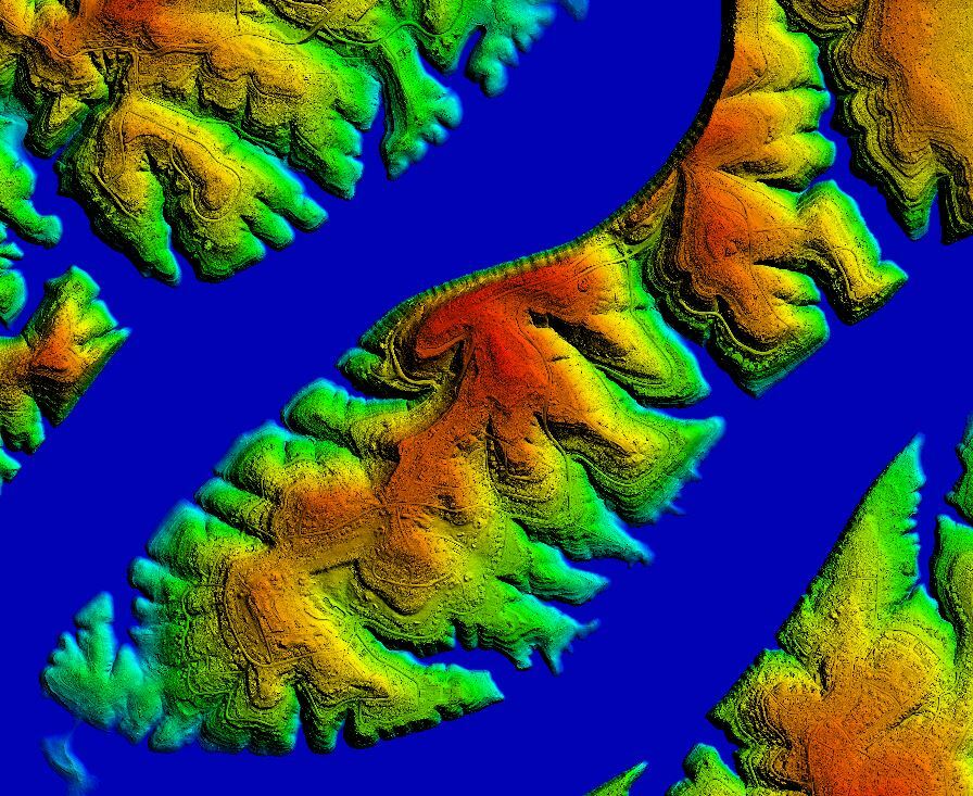
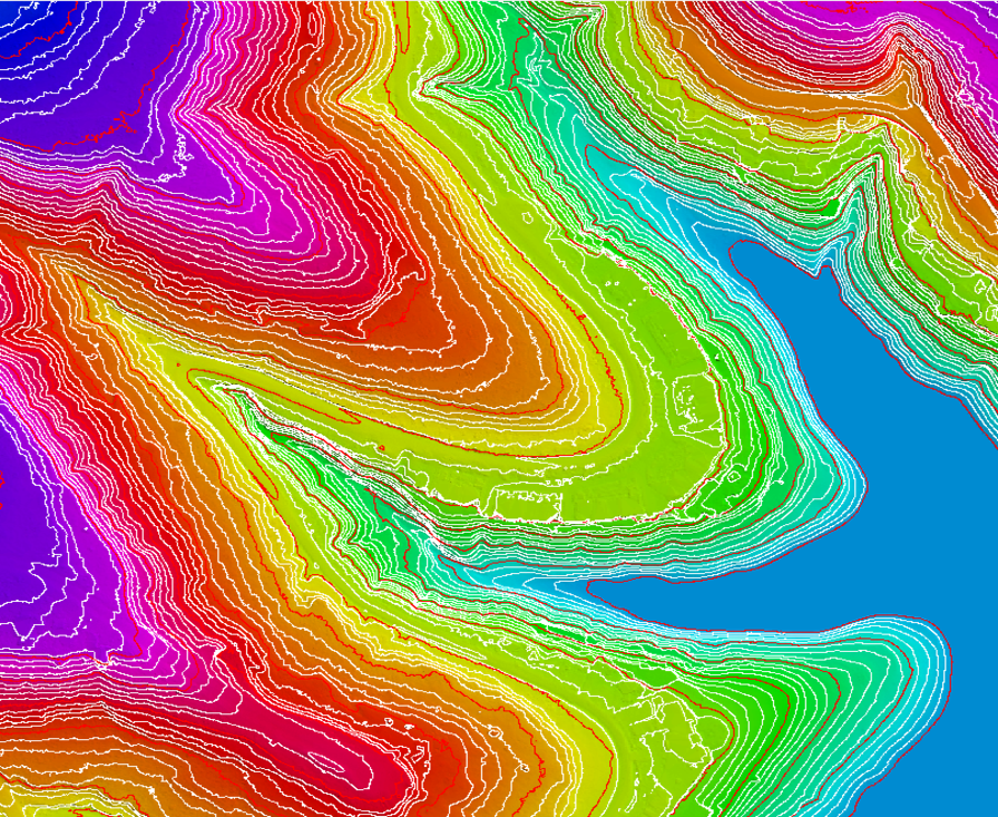
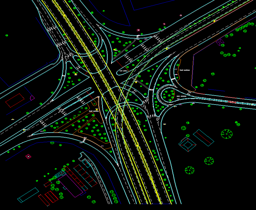
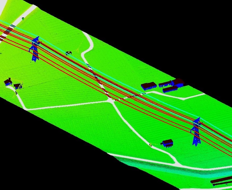
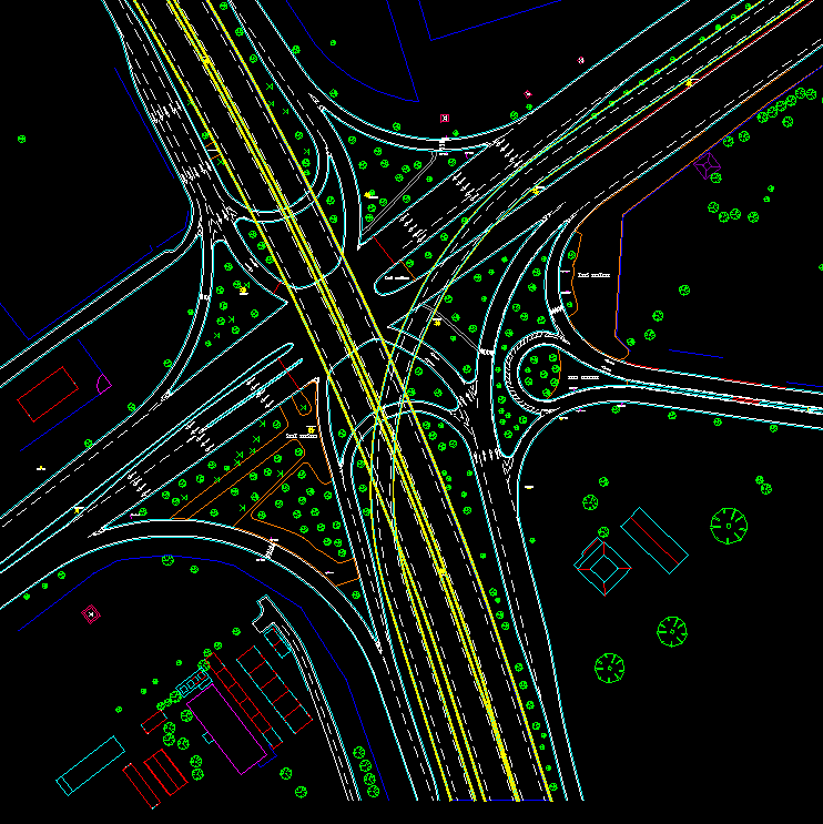
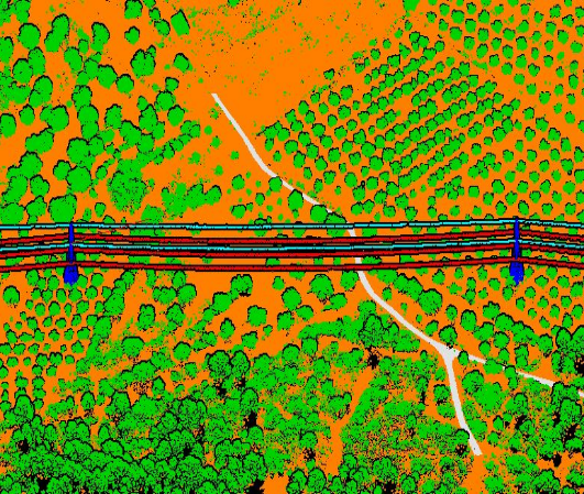
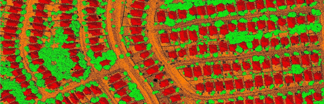
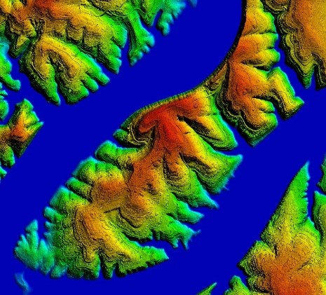
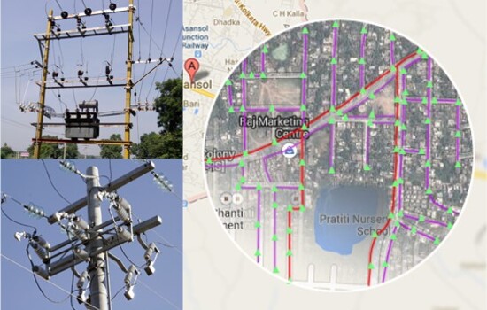
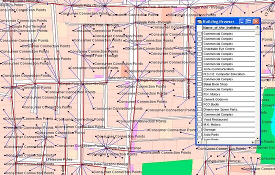
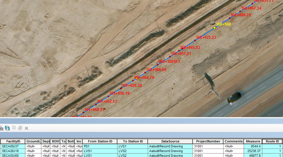
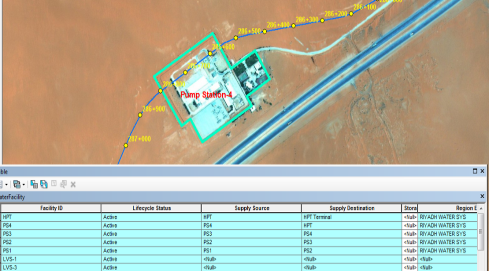
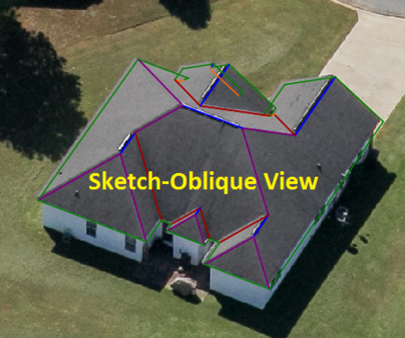
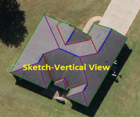
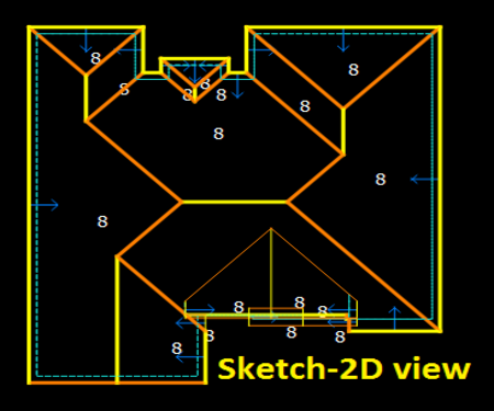
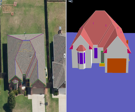
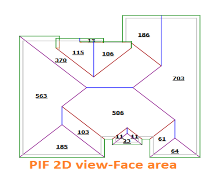
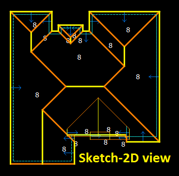
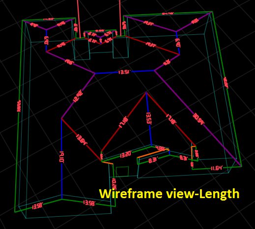
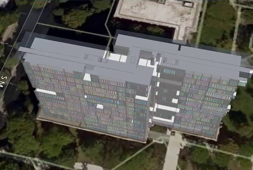
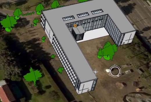
3D Planimetric/Topographic mapping mainly represents the earth surface features with height elevation from the datum as Point/Symbol/Nodes, line/Polylines and Polygon/region data. With such data user can make different analysis and decisions based on their specific need and applications of feature like building outline, building ridge line, building highest elevation, roads, ditches, drains, bridges, ponds, rivers, dam, vegetation, trees, utility poles, manhole, catch basin etc.

DTM / DEM / DSM (Digital Surface Model)

Data collection for creation of the Digital Terrain Model (DTM), Digital Surface Model (DSM), and Digital City Model (DCM) etc. is made by 3D data extraction from stereo pairs as a set of points, line and polygon data. Sometime it is a collection of discrete elevation points at regularly spaced intervals. The model reflects abrupt changes in relief such as incised streams, ridge lines, and slope breaks. Digital elevation models are used as the basis for the elevation representation by contour lines and height spots on topographic maps. It is also one of the input items for making a digital orthophoto.

It can be extracted by employing different methods and strategies like Automatic, Semi-automatic and Manual terrain extraction with surface features and without surface features etc. from aerial stereo images. Further it is used in various spatial analysis and algebra of the terrain depending on the requirements like cut and fill, slope and aspect, hill shade analysis etc.

LiDAR SERVICES:

LiDAR (Light Detection and Ranging) is a remote sensing method which is used for measuring the exact distance of an object on the earth’s surface. This technology allows Mapping professionals to examine & analyse both natural & Man made features with precision accuracy. LiDAR is used in a wide range of Land management services includes Forestry, Agriculture, Watershed Management & Geomorphological Mapping etc. Along with, it is highly instrumental in preservation of manmade assets such as Electrical & Highway etc.

WET has expertize  & experience in dealing with both Airborne & Terrestrial LiDAR.

Our gamut of LiDAR Services includes:
  • Bare Earth Extraction (DEM/DTM)
  • Hydro flattened Break line & Contour
  • Advanced Classification
  • Powerline Corridor Mapping
  • Planimetric Asset Mapping & Modelling

LIDAR SERVICES:

Our gamut of LiDAR Services includes:
  • Bare Earth Extraction (DEM/DTM)
  • Hydro flattened Break line & Contour
  • Advanced Classification
  • Powerline Corridor Mapping
  • Planimetric Asset Mapping & Modelling

LiDAR (Light Detection and Ranging) is a remote sensing method which is used for measuring the exact distance of an object on the earth’s surface. This technology allows Mapping professionals to examine & analyse both natural & Man made features with precision accuracy.

LiDAR is used in a wide range of Land management services includes Forestry, Agriculture, Watershed Management & Geomorphological Mapping etc. Along with, it is highly instrumental in preservation of manmade assets such as Electrical & Highway etc.


WET has expertize  & experience in dealing with both Airborne & Terrestrial LiDAR.

GIS Services

WET has a dedicated team of professionals with having more than a decade worth of experience in various domains of Geographic Information System (GIS). The team is committed to pursue continuous improvement and innovation, in order to be able to provide faster turn-around times and high quality deliverables. Moreover, we continue to do investment in people, who are being provided rigorous training to handle the growing needs of our clients.

Businessman using mobbile phone with Smart city and wireless communication network new technology concept.

GIS Services

WET has a dedicated team of professionals more  than a decade worth of experience in various domains of Geographic Information System (GIS). The team is committed to continuous improvement and innovation in order to be able to provide faster turn-around times and high quality deliverables. Moreover, we continue to investment in people, who are being provided rigorous training to handle the growing needs of our clients.

GIS Services for Utility Mapping

GIS centered utility mapping is one of the necessities of recent infrastructure management. Expansion is being made on several modern utility supply lines viz. telecommunication Network, Electrical Network, Water Supply, Sewage, and Gas Pipe Lines. Therefore, the utility component must be functional without intervention and it is very challenging to manage it manually.  So, Geospatial data offers spatial dimension to its management

Telecommunication Network
  • Telecommunication Network Creation/Updation, Optical Fiber Cable (OFC) Network Monitoring & Management
  • Data handling and Data Migration
  • Capacity Planning & Demand Forecasting
  • Outage Management
Electrical Network
  • Distribution network of electricity lines (HT-High tension line and LT-Low tension lines)
  • Electricity network distribution information (HT-High tension line and LT-Low tension lines)
  • Monitoring & Management
  • Consumer Indexing
  • Outage Management
Gas, Water & Sewerage
  • GAS, Water, Sewerage Network Creation/Updation on Base Map of Project area
  • Network Distribution for Gas Supply, Water Supply & Sewerage
  • Monitoring & Management
  • Outage Management for GAS Supply and Water Supply
GIS Analytics

We provide location-based data analysis which is applicable for various sectors and industries such as – 

  • Education Centers
  • Hospitals and Health Facility
  • Banking Facility and ATMs
  • Charging Stations/Petrol Pumps/GAS Filling Stations
  • Business Centers
  • Waste Disposal Center
  • Geocoded locations
Artificial Intelligence (AI) in GIS

Artificial Intelligence is a type of technology of making intelligent machines, especially intelligent computer program that enables machine to do cognitive processes. AI GIS is a combination of AI technology with various GIS functions, including spatial data processing and analysis algorithms (GeoAI) that incorporates AI technology and a general term for series technologies of the mutual empowerment of AI and GIS.

Machine Learning is the core of artificial intelligence and deep learning is the hot research direction in the core. GeoAI includes two parts viz;  Geospatial Machine Learning and Geospatial Deep Learning, which caters to

  • Geographic Data Mining (GDM)
  • Optical Character Recognition.
  • Artificial creativity and Computer vision
  • Virtual reality
ARTIFICIAL INTELLIGENCE (AI) IN GIS:
  • Geographic Data Mining (GDM)
  • Optical Character Recognition.
  • Artificial creativity and Computer vision
  • Virtual reality
Artificial Intelligence is a type of technology of making intelligent machines, especially intelligent computer program that enables machine to do cognitive processes. AI GIS is a combination of AI technology with various GIS functions, including spatial data processing and analysis algorithms (GeoAI) that incorporates AI technology and a general term for series technologies of the mutual empowerment of AI and GIS. Machine Learning is the core of artificial intelligence and deep learning is the hot research direction in the core. GeoAI includes two parts viz;  Geospatial Machine Learning and Geospatial Deep Learning, which caters to
Disaster Management and Property Insurance

Under certain Natural Disaster Condition, there is an “On Demand” of the work to be delivered on a war footing manner.  Hence, resources are to work in such a way that they can deliver the data to meet the insurance demand of the people on time. We have dedicated resources for this on demand Job.

To measure the geometry of the structure and thus cost calculation for helping in quick settlement of insurance claims (Building Structure damaged due to Cyclone/Earthquake/Natural Calamities).

3D sketch creation of the Building/Structure along with collection of precise information of the property through following inputs:

  • Ortho Imagery
  • Oblique Imagery
  • UAV/Mobile Imagery
  • Blueprint of the Property to be Modelled

Capturing of attribution information includes:

  • No. of floors
  • Living space area
  • Non Living space area (porches, deck & Patio area)
  • Roof Vents
  • Chimneys
  • AC Units
  • Garages
  • Rain Gutters
  • Roof Material
  • Wall Material
  • Information on Basement
  • Total Perimeter, Length of ridge (flat & hip) & valley line
  • Pitch & area different roof faces
  • Area of roof faces with opening areas & perimeter for Entrances & Windows.
  • Shape, dimension & area of Doors & Windows
  • Detail of outer objects like Trampoline, Swimming pool, Sports court & tree cover etc.
DISASTER MANAGEMENT AND PROPERTY INSURANCE:

Capturing of attribution information includes:

  • No. of floors
  • Living space area
  • Non Living space area (porches, deck & Patio area)
  • Roof Vents
  • Chimneys
  • AC Units
  • Garages
  • Rain Gutters
  • Roof Material
  • Wall Material
  • Information on Basement
  • Total Perimeter, Length of ridge (flat & hip) & valley line
  • Pitch & area different roof faces
  • Area of roof faces with opening areas & perimeter for Entrances & Windows.
  • Shape, dimension & area of Doors & Windows
  • Detail of outer objects like Trampoline, Swimming pool, Sports court & tree cover etc.

Under certain Natural Disaster Condition, there is an “On Demand” of the work to be delivered on a war footing manner.  Hence, resources are to work in such a way that they can deliver the data to meet the insurance demand of the people on time. We have dedicated resources for this on demand Job.

To measure the geometry of the structure and thus cost calculation for helping in quick settlement of insurance claims (Building Structure damaged due to Cyclone/Earthquake/Natural Calamities).

3D sketch creation of the Building/Structure along with collection of precise information of the property through following inputs:

  • Ortho Imagery
  • Oblique Imagery
  • UAV/Mobile Imagery
  • Blueprint of the Property to be Modelled
Geo BIM Services

BIM and GIS integration is the process of blending the BIM model into layers of the geospatial context. So, designers can use GIS to get the most accurate information about some areas where construction is to take place.

The use of BIM and GIS introduces a whole new spatial element to this smart and innovative industrialized construction process with one simple goal in mind – to increase the efficiency of the entire design and construction process. 

 As part of Geo-BIM services, WET delivers Geospatially positioned model along with Revit BIM Model.  It can be viewed in GIS platform superimposing with World Imagery

GIS Consultancy

Geospatial Consulting Services are the one of the core domain expertise of WET. Having Experienced, Well qualified experts in the field, it provides consulting services for

  • All domain of Geospatial Technology
  • Natural Resources Management
  • Utility Sectors
  • IT enabled GIS Services
  • Site Suitability Analysis
X